The first day of the Ski Trail
At the end of January, we helped to prepare the trail network at Lenningen, and we also took a trip up the terrain to Spåtind with Syver Thon, owner of Lenningen Fjellstue. We joined Syver from start to finish in his grooming machine and prepared first-class ski trails from Lenningen Fjellstue, out into Langsua National Park, around Røssjøen and along Ølsjølitoppen hyttefelt.
Syver Thon has 18 years of experience in creating ski trails at Lenningen, and he makes sure to prepare high-quality ski trails for cabin owners and businesses at Lenningen. Lenningen Fjellstue and Valdres Trekkhundklubb also provide trails for dog sledding, and these trails extend all the way to Beitostølen.
We had the pleasure of following the process of preparing one of the Valdres the best ski trail network, and got documented the trip from start to finish, with the exception of protected areas in the nature reserves and national park where it is not allowed to fly by drone. On the ski slopes we met happy cabin owners who showed a great degree of gratitude for the job Syver does, and the quality of the slopes that are being groomed with Lenningen as a starting point.
Watch our YouTube video from the ski tour with Lenningen Løypelag:
The second day up Fortune
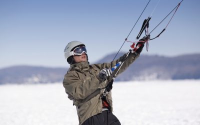
The following day, we were invited out into the fine weather to drive up the first trails of the season up the terrain towards Spåtind. Here we first had to plow tracks up in the powder snow towards Spåtind, and we got to witness a skier with a snow machine that can apparently make its way everywhere there is snow.
On the way up to Spåtind, you can look out over the Norwegian mountain landscape towards Hallingdal, Hurrungane in Sogn, Jotunheimen, Norefjell, Rondane, Østerdalen and far into Sweden. Syver pointed out that Spåtind is the vantage point in Norway where you can see the largest part of Norway, and at 1414 meters above sea level from the top of Spåtind in Valdres you have a unique overview of the Norwegian mountain landscape.
Watch our Youtube video from the trip up to Spåtind with Lenningen Løypelag:
«LenningenTrail team prepares the trails based on Lenningen. In total, approx. 60 km of trails are prepared, covering the areas Lenningen around 9.9 km., Holbekkrunden 12.3 km., Røssjøen around – Lundsætra 19.0 km., Rotvollrunden 5.9 km., Tverrløype Fjellheimen 0.7 km., Ølsjølli – Elveseter 6.5 km., Rotvollrunden 5.9 km. See the trail machine's movements on: www.skisporet.no
A significant effort is being made to offer great ski trails in Synnfjellet. Each area has its own preparation machines and trail riders. This gives us a continuous trail network of almost 300 km."
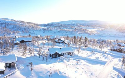
Finally, we would like to thank Lenningen Løypelag and Syver Thon for having been invited to two good days in the ski track at Lenningen, and we look forward to being able to further showcase the trail network around Lenningen and in the immediate vicinity of Ølsjølitoppen Cabin field.
Web developer Taulant Shamolli from Meta IT has designed a video from the ski slope network at Jomfruslettsfjellet, and we share this as a little extra bonus:
4K | Cross-country skiing | Jomfruslettfjellet Norway | DJI Mavic Air 2
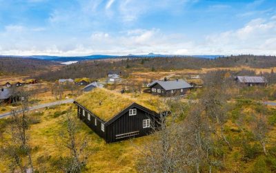
Read more about activities around Ølsjølitoppen Cabin field
Social Media
Facebook: https://www.facebook.com/Olsjolitoppen
Instagram: Olsjolitoppen
YouTube: Olsjolitoppen
Facebook: Friends of Lenningen Trail Team